Großer Rachel
description
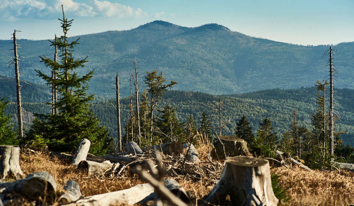
The Großer Rachel with its 1453 m is the second highest mountain in the Bavarian Forest. The view from the top ranges from the Osser and the Großer Arber in the north west to the Dreisessel mountain in the south east.
The Großer Rachel is the landmark mountain of the municipalities Frauenau and Spiegelau. Starting points for the climbs are the places Oberfrauenau, Klingenbrunn Bahnhof, Parkplatz Gfäll or the "Racheldiensthütte". On the mountain you can rest and stop for a bit to eat in the mountain shelter "Waldschmidthaus" at 1360m height. In winter the mountain can only be climbed with touring skis or snow shoes because of the meter-high snow.
South east of the summit round 400m deeper the Rachel lake is located. According to the legend it "accommodates" the burned soul of the evil Wecklin, one of the lords of the castle from Rammelsberg near Schönberg. The ice age cirque lake is reckoned as the quietest lake of the Bavarian Forest. It is surrounded by primeval forest.
High over the lake on 1212m another popular destination, the "Rachelkapelle" is majestically situated.
North east of the mountain on Czech territory in the Rachel forest (Roklanský les) the spring area of the Kleiner Regen and the Großer Müllerbach (Roklansky potok) are located. From the Czech side the Rachel cannot be climbed: The traditional starting point, the Rachelhütte (Roklanska chata), is located in the today no longer accessible core zone of the National Park Sumava (Nature Conservation area Maderer tomentum).
media
-

Der Rachelsee, unterhalb des Gipfels Großer Rachelwoidlife photography -
Blick auf den Großen und Kleinen Rachelwoidlife photography -
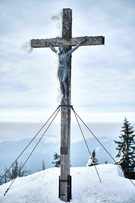
Gipfelkreuz am Großen Rachel im Winterwoidlife photography -
Waldschmidthaus - Schutzhütte Großer Rachel auf 1360 mwoidlife photographie