Großer Falkenstein
description
Lindberg’s landmark mountain
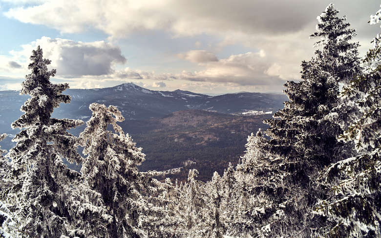
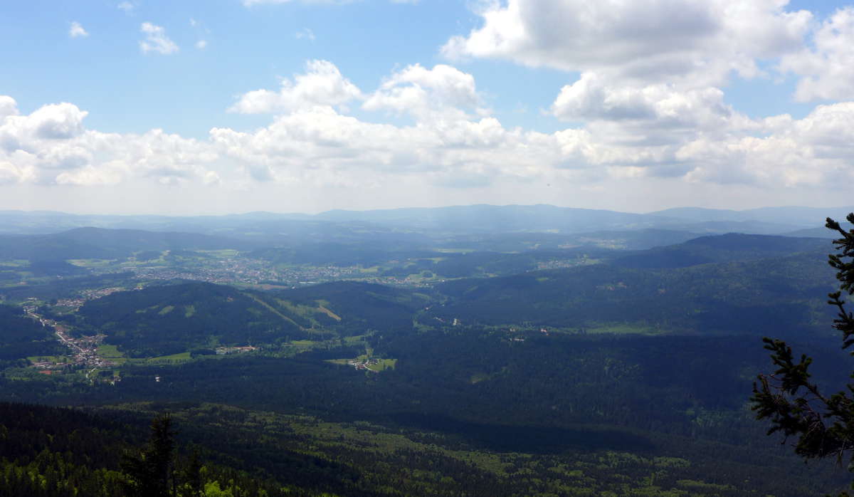
It takes four hours to the top of the 1315m summit of the Großer Falkenstein. Trained hikers with good endurance manage to climb the top of the thounsand meter in the Bavarian Forest even faster. Various hiking paths lead to the Großer Falkenstein whose plateau at the summit offers a wide and free view: to the Rachel and Lusen, over the mountain range of the front of the Bavarian Forest to the Großer Arber, Osser and Hoher Bogen.
The ascent to the summit of the mountain on the linear walks blueberry, yew and ash with the starting points Zwieselerwaldhaus, Kreuzstraßl and Scheuereck is possible in about two hours. On the top you can stay overnight or make a rest and have something to eat at the mountain shelter of the Bayerischer Wald-Verein.
Hiking tip: Primeval Forest Tour
The path over the Zwieselerwaldhaus leads the hiker through the primeval forest area Mittelsteighütte and with this directly "back to the roots". On the 36 ha areal the primeval mixed forest of spruces, firs and beeches is still growing with up to 500 years old trees.
Hiking tip: Höllbachgspreng
The Höllbachgspreng at the foot of the Großer Falkenstein is one of the oldest conservation areas in the Bavarian Forest and since 1997 part of the National Park. The ascent in the ethnic landscape demands endurance and surefootedness therefore you can enjoy the wild beauty over wide distances on your own and in peace and tranquility.
Start with this day excoursion with the Falkenstein bus at the station in Zwiesel. In Scheuereck you can tie your hiking boots and march along the marker "dusty miller" in around three hours along the Höllbach to the Höllbachschwelle and then on the marker "blueberry" steep uphill in the rocky region of the primeval forest relict Höllbachgspreng and the Höllbach falls. The way back leads in around an hour on the marker "Yew" over the rock massif of the Kleiner Falkenstein to the place Zwieselerwaldhaus.
Alternatively the way over the Ruckowitzschachten on the marker "green triangle" can be chosen. It also leads through the primeval forest area "Mittelsteighütte" to the place "Zwieselerwaldhaus", it takes about half an hour longer.
media
-

Gipfel des Großen Falkensteins im OktoberTourist-Information Lindberg -
Winterlicher Ausblick vom Großen Falkensteinwoidlife photography -
Blick vom Falkenstein ins ARBERLANDARBERLAND REGio GmbH -
Von Schneegestöber bedecktes Gipfelkreuz des Großen Falkenstein.woidlife photography -
Das Höllbachspreng auf dem Weg zum Großen FalkensteinARBERLAND REGio GmbH